Private land opportunityCañas · Azuero Peninsula · Panama
Approximately 64 Hectares.One Remarkable Landholding.
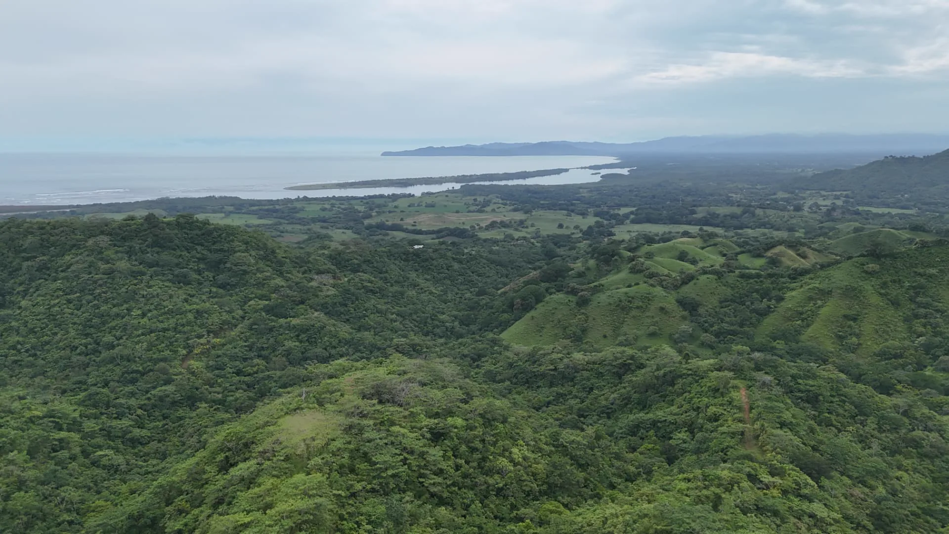
Cañas Horizon is an approximately 64-hectare private landholding for sale in Cañas, Tonosí, on Panama's Azuero Peninsula, approximately 15 minutes by car from Playa Venao. Across substantial elevated areas the landscape opens toward Isla Cañas and the Pacific Ocean.
Property at a glance
≈ 64 HECTARES
Approximately 640,000 m²
A substantial landholding in Cañas, Tonosí, Los Santos.
Areas are approximate. Further figures are published only as they are verified.
- Scale
- ≈ 64 hectares
- Approximately 640,000 m²
- Location
- Cañas, Tonosí
- Los Santos, Panama
- Outlook
- Isla Cañas & the Pacific Ocean
- Across substantial portions of the property, including elevated areas.
- Offering
- Offered as one landholding
Large landholdings offer something smaller parcels cannot: the ability to consider landscape, access, privacy, conservation and future development as one integrated whole.
This approximately 64-hectare property is being offered as a single acquisition opportunity.
The land
A landscape at scale.
Large landholdings offer something smaller parcels cannot: the ability to consider landscape, access, privacy, conservation and future development as one integrated whole.
Across substantial parts of this approximately 64-hectare property — some 640,000 m² in Cañas, Tonosí, Los Santos — the landscape opens toward Isla Cañas and the Pacific Ocean, creating an important relationship between terrain, elevation and outlook.
The property is being offered as a single acquisition opportunity. Its future may be approached in different ways, subject to technical feasibility, planning requirements and applicable approvals.
Explore the Property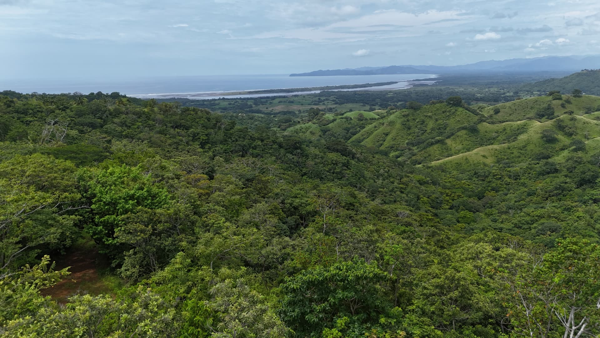
Property Explorer
Interactive property mapping will be added from the completed survey, aerial and GIS material.
The outlook
Land shaped by its relationship with the Pacific.
From elevated areas across the property, the landscape opens toward Isla Cañas and the Pacific Ocean.
These outlooks are one of the defining characteristics of the land and will be documented through aerial photography, ground-level imagery and terrain mapping.
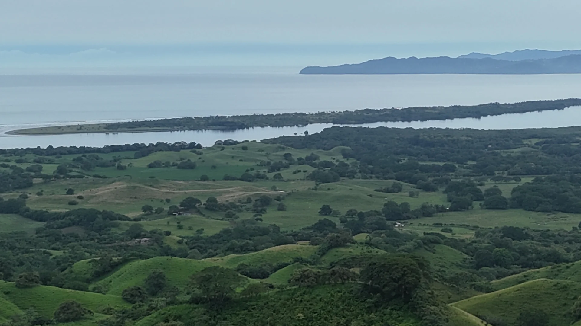
The property is not offered as oceanfront land. Outlooks are described qualitatively and will be mapped once terrain analysis is complete.
Location
Cañas, on Panama's Azuero Peninsula.
Cañas lies in the district of Tonosí, province of Los Santos, on the southern side of the Azuero Peninsula — approximately 15 minutes by car from Playa Venao.
- 01Panama
- 02Azuero Peninsula
- 03Los Santos
- 04Cañas
- Playa Venao
- Approximately 15 minutes by car
Possibilities
Room for different visions.
The property is being offered without imposing a predetermined development concept. Its scale allows prospective buyers to evaluate different approaches to the land.
- 01
Private Estate
A substantial private landholding shaped around landscape, privacy and nature.
- 02
Low-Density Residential
Potential for a landscape-led residential concept in which terrain, privacy and outlook toward Isla Cañas and the Pacific can inform the placement of future development, subject to planning and technical feasibility.
- 03
Hospitality & Wellness
The property's scale, landscape and Pacific outlook create an opportunity to explore boutique hospitality, retreat or wellness concepts, subject to feasibility and approvals.
- 04
Conservation-Led Development
An approach in which development and long-term landscape preservation may be considered together.
Illustrative potential uses only. No representation is made that any particular development, subdivision, density or use has been approved.
Explore possibilitiesTerrain & LiDAR
Understand the land before imagining what comes next.
Professional LiDAR and topographic work has been commissioned to create a detailed understanding of the property's terrain.
This technical material will help prospective buyers understand elevation, slopes, access and the relationship between different areas of the property and their outlook toward Isla Cañas and the Pacific Ocean.
Technical material being prepared
[3D TERRAIN MODEL]
LiDAR visualization to be added once the commissioned survey outputs are complete.
- 3D terrain
- Digital terrain model
- Digital surface model
- Point cloud
- Contours
- Slope
- Elevation
- Property boundary
- Isla Cañas orientation
- View corridors
Technical foundation
A more informed starting point.
Documentation is assembled progressively. Items are listed with their current status rather than presented as complete.
- Available
Historic Survey Documentation
Existing survey and cadastral documentation.
- In preparation
LiDAR Survey
Commissioned; outputs being processed.
- In preparation
Topographic Survey
Commissioned; outputs being processed.
- On request
Additional Technical Material
Released to qualified prospective buyers as it is completed.
Gallery
The landscape.
Photography, drone imagery and video of the property itself are being produced. No stock photography is used in place of the land.
Aerial
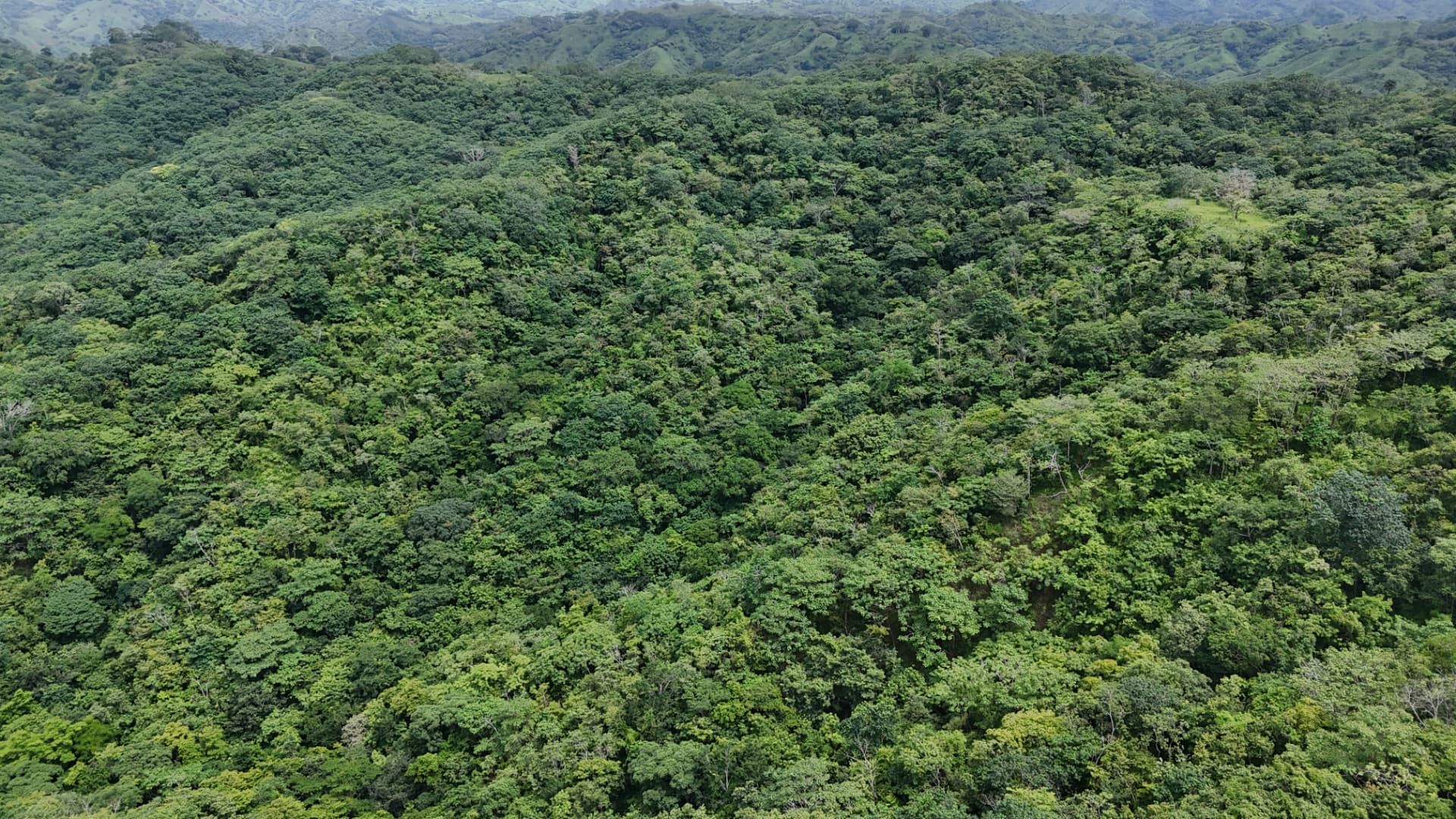
Isla Cañas & Pacific
Landscape
Terrain
Access
Detail
Regional context
Private sale process
Information, progressively disclosed.
Detailed information about the property is shared in stages, so that prospective buyers can review material appropriate to their level of interest.
- 01 — Explore
Review the public overview, location, landscape and technical context.
- 02 — Request information
Request the Investment Memorandum and provide basic information regarding your interest.
- 03 — Due diligence
Qualified prospective buyers may receive access to additional technical, cadastral and legal information.
Private viewings
Arrange a viewing of the land.
Viewings of the property in Cañas are arranged privately, by appointment. Share your details and we will respond personally to agree a suitable date, or message us directly on WhatsApp.
A significant landholding deserves serious consideration.
For further information regarding this approximately 64-hectare private land opportunity in Cañas, request the Investment Memorandum.